
Current Avalanche Conditions
USE AT YOUR OWN RISK. THIS INFORMATION IS PROVIDED “AS IS” AND IN NO EVENT SHALL THE PROVIDERS BE LIABLE FOR ANY DAMAGES, INCLUDING, WITHOUT LIMITATION, DAMAGES RESULTING FROM DISCOMFORT, INJURY, OR DEATH, CLAIMS BY THIRD PARTIES OR FOR OTHER SIMILAR COSTS, OR ANY SPECIAL, INCIDENTAL, OR CONSEQUENTIAL DAMAGES, ARISING OUT OF THE USE OF THE INFORMATION.
10 p.m. Tuesday, March 2, 2021
COPPER RIVER HIGHWAY AVALANCHE HAZARD
Current: LOW
Outlook: The hazard should remain the same through the weekend.
BACKCOUNTRY AVALANCHE HAZARD
Above Tree Line: MODERATE Use caution on western aspects.
Tree Line: MODERATE Use caution on steep slopes.
Below Tree Line: LOW
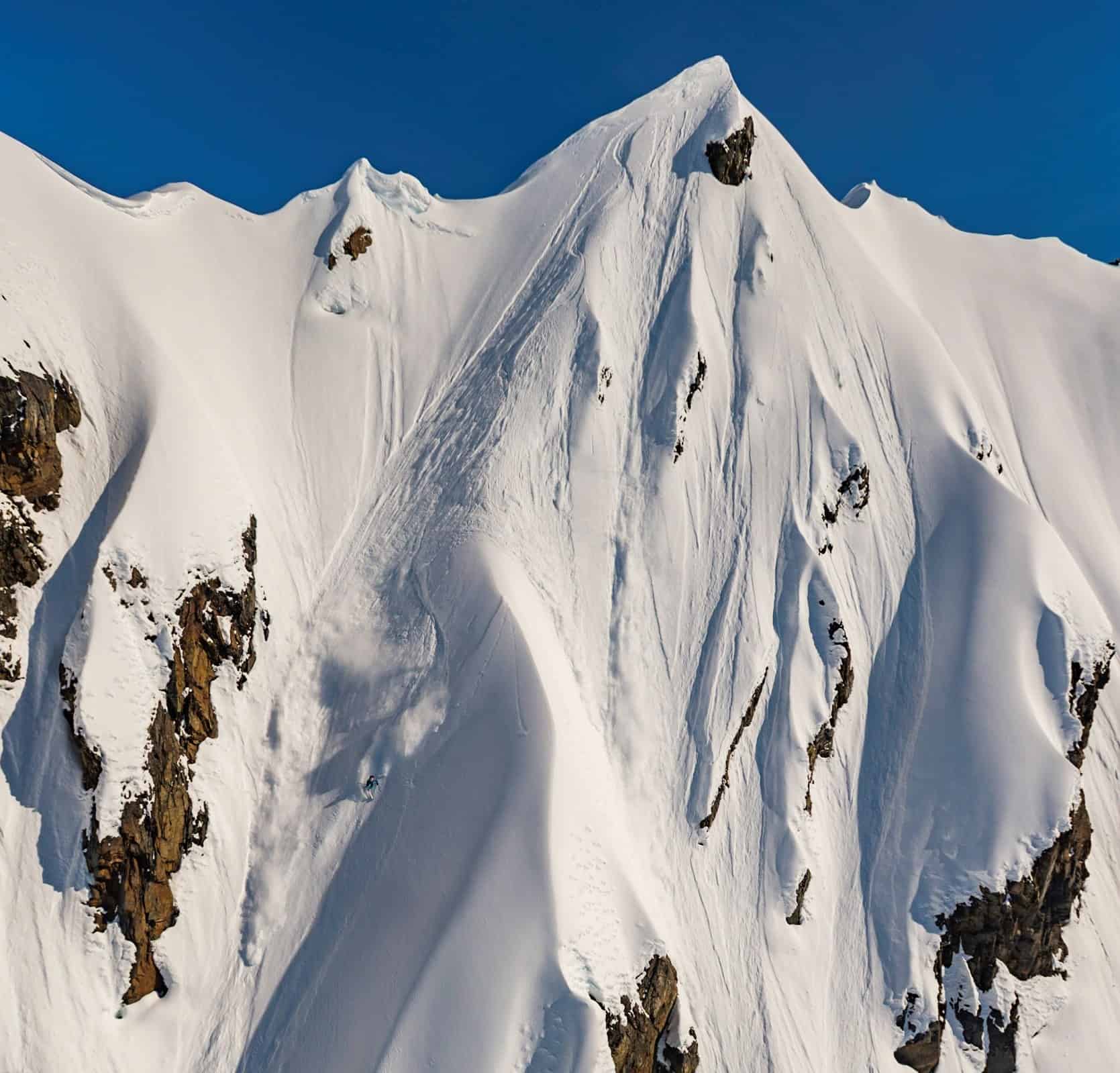
We’ve had a busy few days of weather. An inch of water fell Saturday into Sunday with the freezing line at mid-mountain. Another inch of water Monday brought a foot of snow to all elevations. Moderate wind loaded western aspects. Precipitation ended Tuesday. Observations have been limited, though some human triggered events have occurred. As daylight increases, sunshine is also starting to play a bigger role.
Expect mostly dry, cool weather to promote snow stability through the weekend. Be wary of increasing daytime temperatures and sunshine on southern slopes.
Backcountry forecasts sponsored by:
Alaska Avalanche Information Center
For more avalanche information from around Alaska visit:
Current avalanche activity is an important factor in avalanche forecasting. Please report all observed avalanche activity.
USE AT YOUR OWN RISK. THIS INFORMATION IS PROVIDED “AS IS” AND IN NO EVENT SHALL THE PROVIDERS BE LIABLE FOR ANY DAMAGES, INCLUDING, WITHOUT LIMITATION, DAMAGES RESULTING FROM DISCOMFORT, INJURY, OR DEATH, CLAIMS BY THIRD PARTIES OR FOR OTHER SIMILAR COSTS, OR ANY SPECIAL, INCIDENTAL, OR CONSEQUENTIAL DAMAGES, ARISING OUT OF THE USE OF THE INFORMATION.